Tuesday, 29 December 2009
RUNNING FOR THE BORDER
Nothing was going to stop us! Wind, punctures, stomach problems, road works, hills, bad weather, heat and humidity - all had to be coped with in our quest to cross the border into Malaysia not later than 26 December. (I exagerate a bit, because the wind was often in our favour and there were only a few moderate hills - although my tyres have worn to the point where I suffer a glass puncture almost every day). We were allowed "NO FEAR" in our efforts, as the road sign in the picture indicates ("ban Bang Boet"). However, in our Southern rush we did manage to stay over at some of the nice spots where we'd previously been (what a good thing we'd already cycled this way earlier in the year when we had the time). Well, we made it into Malaysia in the afternoon of the 26th (due date), and managed to cycle to the coastal town of Kuala Perlis by evening. The following morning we took a ferry boat to the resort island of Langkawi, about 30 km off the mainland coast. I need some time to unwind, and have been relaxing on the island for a day or 2 now. Leana obviously has more energy, as she quietly packed up and left this morning (or perhaps it's just that I'm not the best person to get along with!). There are some obvious differences between Thailand and Malaysia, the most notable being that Malaysia is predominantly an Islamic country. In Thailand women are often "skimpily" dressed, whereas in Malaysia they tend to be covered up, often with head scarves and all. In Thailand there are many Buddhist Wat's around, but here every town has it's mosque with the Immam calling the faithful to prayer. For me Malaysia is also much more expensive than the previous SE Asian countries where I've been, so I'll have to pinch my pennies. Otherwise there is no immediate rush, as I have a free stay of 3 months in this country. Daily distances cycled since Bangkok have been:- Puktian Beach 151 km; Prachuap Khiri Khan 146 km; Bang Saphan 101 km; Chumphon 118 km; Chayo 142 km; Chawang 146 km; Phattalung 125 km; Hat Yai 107 km; Kuala Perlis (Malaysia) 109 km; and Langkawi Island (after ferry boat) 26 km. Total distance cycled since Cape Town is 52 457 km.
Thursday, 17 December 2009
SCHOOTING THROUGH SIAM
After sharing a barge with a number of large trucks across the Mekong from Laos, Leana and I were not surprised to only receive the miserly 15-day Thai visa usually issued at land borders. We weren't sure about a visa extension in Bangkok, so we made haste in a Southerly direction. Fortunately the route allowed for some speedy cycling, and even on the few occasions where we had to cross hills the good road was a pleasure. We mostly camped on the grounds of Buddhist temples and at petrol stations (convenient toilets, water, and usually a 7-Eleven shop). Just North of Bangkok we arrived early at the former Siamese capital of Ayuttaya, where we fortunately found cheap rooms. The place was pretty much destroyed in a war a few hundred years ago, but walking around the old river-bound city one can still observe many interesting remains of the former glorious palaces and temples. Then it was on to the present Thai capital, Bangkok, working our way through many kilometers of heavy traffic before reaching the crazy tourist-haven suburb of Banglamphu. Eight months and 12641 km later, we booked into another cheap guest house not far from where we'd stayed on our first visit to the city. Hoping for a visa extension it was a bit of a mission finding the Bangkok Immigration Bureau. Traveling by river ferry, sky-train, and taxi, we were dismayed to discover that the visa office had recently moved to the far Northern suburbs of the city. Another train and bus ride later we reached the place, and after going through all the bureaucratic "red tape" only Leana got an extension for a further 7 days. (The short extension costs a lot of money, and none of the many ATM's there were prepared to give me any. The next morning I managed to squeeze out my last few cents, and I had to go all the way back to that miserable office for the essential stamp in my passport). Today we were still in Bangkok as Leana had some unfinished business to take care of, so I spent most of the day working on the bikes. Daily distances cycled since my last update were:- Thoeng 88 km; Phayao 103 km; Rong Kwang 130 km; Uttaradit 102 km; Phitsanulok 107 km; Nakhon Sawan 149 km; Chaiyo 126 km; Ayuttaya 50 km; and Bangkok 83 km. Total distance cycled on this trip is 51286 km.
Friday, 4 December 2009
SAARTJIE PUTS HER FEET UP
Don't panic, as my bike (Old Saartjie) hasn't gone into permanent retirement. After reaching our Northern-most point in China (Chengdu city), Leana and I had to head back South, visa expiry being just one of the reasons for the hasty retreat. So, first of all we had an interesting 19 hour train trip from Chengdu back down to Kunming. I arrived back at Cloudlands Hostel in Kunming to find quite a gathering of long-term cyclists (about 10 of us in total). We'd all been travelling individually or in pairs, and had followed different routes, but all of us moving South to escape the harsh Chinese winter (Germans Robert and Martin in picture). My efforts to get on an overnight bus from Kunming down to Jinghong were in vain, as there was no space for the bike and my ticket was refunded. However, the next day both Leana and myself were more fortunate and made the 9 hour bus ride down to Jinghong which is less than 200 km from the Laos border. Although the "moving parts" on Old Saartjie were spared due to the train- and bus travel, there is - as usual - some sort of damage, but fortunately not too serious. After the short rest my poor old bike had to hit the road running - on the 2nd day after resting she cracked the 50 000 km barrier on this trip. From Jinghong Leana took another bus further on to Laos, while I preferred to cycle (we'd both been suffering from a bout of flu, but I'd recovered sufficiently to be able to cycle). I'd rather not say anything about Swine Flu, as you never know who may read this report and I don't fancy any time in quarantine. I was sorry to leave China, but Laos is a good relaxing place to go from there. However, there hasn't been much time to relax, as in only a few days I've cut through the "short NW" corridor of Laos. I've also finally caught up with Leana in the town of Houei Xai, on the Mekong river. I arrived here in the gathering darkness after racing the sun before it disappeared into the river. On the opposite bank of the Mekong lies Thailand, where we plan to take the ferry tomorrow. Distances cycled since Chengdu have been:- To and from railway stations Chengdu & Kunming 15 km; To and from bus terminals Kunming & Jinghong 23 km; Menglun 76 km; Mengla 77 km; Luang Namtha (Laos) 110 km; Vieng Phouka 65 km; and Houei Xai 124 km. Total distance cycled since leaving Cape Town at the start of this journey is 50 348 km.
Tuesday, 1 December 2009
CHILLING TO CHENGDU
The rain in Yibin (where I posted my previous report) was just the start of an unusually cold spell for S-China so early in winter. According to the weather reports there was snow all around us, but Leana and I were fortunate enough to be spared the snow. We did, however, have to contend with some icy rain, and even when it wasn't raining we had to cycle with a few layers of clothing on. For a change there were no serious hills on the route, and we stopped over at a couple of interesting places. The city of Zigong is historically known for it's salt wells, and more recently for it's dinosaur fossils and renowned museum (obviously the dinosaurs were waiting patiently to be discovered since long before the salt mining). Leshan, another Sichuan province city on the Min river, is a favourite tourist destination mainly due to it's ancient "Grand Buddha". In the freezing drizzle we took a sight-seeing ferry down the river to see this 71 m high sitting Buddha which has been carved from the river-side cliffs. In another city at the end of one particularly long freezing day, I walked out to get some necessities, and decided to buy some fried potatoes from an old lady on the corner. I was still wearing my rain jacket and cycling tights, and hadn't yet washed the "road muck" off myself - so I probably looked like something which the cat may have left on the doorstep. However, the old lady refused to serve me, and instead she threatened to clobber me with her food ladle (the beard probably added to the consternation, and I've since had it trimmed again). As we approached Chengdu the area along the road became increasingly built-up (with endless high-rise buildings almost all the way from Leshan - more than 150 km away). Chengdu is certainly the largest and most crowded city which I've visited in China, and we spent an exciting hour or more in the rush-hour darkness being directed to all corners of the earth in search of Sim's Hostel - which we eventually found. Distances cycled since Yibin were:- Zigong 107 km; Rongxian 48 km; Leshan 92 km; Meishan 89 km; and Chengdu 98 km.
Wednesday, 11 November 2009
THE RIVER ROAD
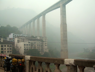
After leaving Xichang city, Leana and I cycled down-river to our next destination of Yibin at the confluence of the Min and Jinsha Rivers, forming the Yangzi River (this may be a bit confusing, as the "Jinsha" is also referred to as the "Yangzi" further upstream). To put it mildly, every day on this stretch has been full of surprises. What also adds to the surprise is that my "maps" are remarkable in their lack of detail (no distances, major towns not listed or in the wrong place, and many place names only written in Chinese script - which, again, does help when asking for directions). Firstly, to get "down-river" we spent the entire first day cycling up a mean mountain, and camped in the freezing cold at over 3100m where our water bottles froze and ice formed on the tents. Over the next 2 days we descended in an Easterly direction for about 150 km before climbing over more high mountains to Leibo lake in the historic Mahu district. Often we cycled on roads of which the surface has been totally destroyed by landslides and rock-falls (at times stones were falling all around us, but fortunately none found their target). However, the scenery was spectacular and the isolated ethnic villagers were wonderful to meet (bustling market-towns with colourfully-dressed villagers and their animals). At times it felt as if I could be in a place like Peru (incidently, I've never been to Peru), as the people were wearing tassled poncho's, women had long plaited hair, scruffy ponies are a popular beast of burden, and homesteads were often almost out of sight way up the mountainside at the end of unbelievably steep footpaths (therefore people also carry heavy loads). As we descended from the highlands into the Sichuan Basin, we found ourselves cycling in a misty haze (a regional winter problem formed by dust and pollution which settles in the deep river valleys). This part of China is also being feverishly developed on a huge scale - incredible highways and cities arising from what were recently still villages. To reach Yibin from where we were in Sichuan province, we had to cross to the South of the Jinsha as far as the city of Shuifu in Yunnan province. The only direct road between Shuifu and Yibin is a new expressway (bicycles not permitted), but we took our chances. About half-way to Yibin the police stopped us at a toll gate, but there was no exit from the highway so they called a pick-up truck from Yibin to load us up and take us about 20 km to the city. (The police are very friendly here, they were even taking photo's of us). Daily distances cycled since Xichang were:- Mtn camp 47 km; Junction town 85 km; Road camp 93 km; Leibo 7 km; Mahu 50 km; Bridge town 58 km; Shuifu 90 km; and Yibin 22 km. Total distance cycled since leaving Cape Town at the start of this journey is 49 424 km.
MOTHER LAKE
After leaving Lijiang for Lugu Lake the road seemed fairly OK for the first while. Then we started dropping down a river gorge, where we met German cyclists Matthias and Katarina pedalling up the hill. We could see a big zig-zag drop ahead of us, and they were the bearers of bad news regarding the troubles awaiting us. By that evening we weren't even half-way up a bad "cobble-stone" 40km hill, and we camped at a rare level spot with water (scaring the poor farmer's goats and pigs beyond recovery). Two nights later we were on another rough-road mountain pass, and camped at 3000m behind a peasant house next to a shed occupied by pigs, chickens, and a dog with puppies (every screech of the tent zipper at night was met by a chorus of grunting, squawking, barking, and puppy wails). Eventually we reached the beatiful Lugu Lake, and spent three nights at different villages on the lake shore. The community around the lake is apparently the only remaining Matriarchal society in the world (women are officially the boss - family lineage is transferred down from the side of the mother). Surprisingly (perhaps because the season was at it's end) there were very few tourists who were almost all local Chinese tourists. The lake is at a level of 2700m, and from there we went down along a spectacular gorge to the county capital of Yam Yuang. The down didn't last very long, however, as within the next two days we climbed everlasting passes, again over 3000m, before reaching the S-Central Sichuan city of Xichang (home of the Chinese satelite launching business). Some of the isolated mountain homesteads supply piped water to trucks and busses for brake cooling down the steep passes (we also camped at some of these - level spot for tents, and water for cooking and washing). Often the local bus passengers suffer from motion-sickness, and they double over at the roadside to violently "bark at the ants". However, once the ever-present scruffy black pigs are released from their over-night accommodation, they waste no time to clean up the mess. One morning I took a walk up the hill and found what I thought was a suitable ditch for my morning ablutions. As I later cycled past that spot I was pleased to note that I hadn't left a permanent blot on the landscape (the busy little pot-bellied janitors were doing their job - one of them still had toilet paper protruding from his jaw). Enough of that for now, until we take on the river road to the East of Sichuan Province. Distances cycled since Lijiang were:- Mtn camp 62 km; Ninglang 74 km; Mtn camp 59 km; Lousui (Lugu Lake) 21 km; Lige (Lugu Lake) 10 km; Wuzhilou (Lugu Lake) 27 km; Yam Yuang 124 km; Yalong River 77 km; and Xichang 79 km. Total distance cycled since the start of this trip is 48 972 km.
Saturday, 24 October 2009
CLIMATE CHANGE
After more than a year of trying to adapt to hot and humid climates, it was a pleasure being able to breathe again at the more comfortable altitudes of SW China. However, the continued move to the NW has brought with it some high altitudes and cold weather (especially with the approach of winter). The route from Dali to Lijiang was fairly uneventful (of course there were some hills!). Like Dali, Lijiang also has an ancient city, dominated by the wooden tile-roofed buildings in the style of the local Naxi people. We are living in the Old City with its cobbled alleys and gushing streams - and of course the local tourists are all over the place again! For a couple of days Leana and I were away from Lijiang, travelling North by bus to the high altitude town of Zhongdian (a.k.a. Shangri-La). That town also has an old part, and is also rather touristy (at that altitude even the cheap youth hostel where we stayed had electric blankets on the beds). I'd taken my bike with on the bus, and spent 2 days cycling back to Lijiang while Leana spent that time hiking in the famous Tiger Leaping Gorge. Zhongdian and the high-altitude rolling plains (3400m) made for rather cool and O2-shy cycling, but the area has a pleasantly strong Tibetan flavour. My cycling route back to Lijiang took me down past the mouth of the Yangzi River Gorge (Tiger Leaping Gorge), as well as the foothills of Jade Dragon Mountain (Mt Satseto 5500m). Tomorrow we plan to cycle NE from here, towards the mystical Lugu Lake on the border with Sichuan Province. Daily distances I've cycled since Dali have been: Songgui 99 km; Lijiang 74 km; Zhongdian (by bus); Qiaotou 106 km; and return to Lijiang 83 km. Total distance cycled on this journey so far is 48 439 km.
Monday, 12 October 2009
NOT THE GREAT WALL
No, the wall in the picture is not THE Great Wall of China. Instead, it is the wall around the ancient town of Dali (wedged between mountains and lake) capital of this region in times past. More recently Dali has become a favourite travelers hang-out, but it seems to be losing popularity due to its increasing touristy nature (around the streets I've seen conspicuously few western travelers, but bus loads of local tourists instead). Another "wall" which I've encountered is the lanuage barrier, and with so many different ethnic groups in this region the accents only complicate matters. For instance, when asking directions to the next major town (thinking I've mastered the pronounciation) villagers don't understand me, and often they pronounce the same name quite differently. It is indeed handy to have a map with place names written in both western and Chinese! In China one can find just about anything - except under arm deodorant. In my efforts to explain to shopkeepers what I want (with my best impression of lifting my arm and applying the roll-on), I've been offered a bizarre range of items - eg. wash cloth, air freshener, hair removal cream, and even an electric razor! The route NW through Yunnan province has not been as hilly as before, although there have been some gear-grinding episodes (there is no flat land here!). In one patch along a river gorge there were a number of pitch-dark narrow tunnels with broken road surface, and in the dark both of us dropped our bikes into the muddy rock-side ditch in an effort to get away from traffic. We took it fairly easy though, as Leana has not yet recovered her fitness after illness. We also took the opportunity to extend our visas for another month in the city of Chuxiong, where we stayed for a day. Daily distances cycled since Kunming were:- A Village 79 km; Lufeng 38 km; Chuxionh 83 km; Shaqiao 61 km; Xianyun 95 km: Xia Guan 71 km; and Dali 14 km. Total distance on this journey cycled is 48 077 km.
Friday, 2 October 2009
GRINDING THROUGH YUNNAN
I lost Leana in the city of Jinghong! She was staying elsewhere, and left before me, I wasn’t sure in which direction. I was planning to head towards the provincial capital of Yunnan province – Kunming – where I could apparently get bike spares, so I headed off in that direction. I expected to cover the less than 500 k’s in 4 or 5 days – after all we’d been on the highway thus far in China, and I didn’t expect that to change. After only a short distance I was in for a rude awakening! The highway turned into a hi-tech Expressway, and I was politely escorted onto the “Old Road” by the police. One of the policemen spoke some English, and he informed me that the old road to Kunming was a “bit further”, there were “some hills”, but I would be “closer to nature”. Of course he was right on all 3 counts, but BY JUPITER what an understatement! The distance to Kunming turned out to be more than 700 km winding up and down serious mountain passes (most of the hills were between 15 and 30 km long). The road condition was somewhat poor in many places, making it rather hard on Old Saartjie (my rather worn-out bike). On day 1 the chain broke, and on day 2 the front brakes packed up – and so it went on. At least I was able to camp a couple of times in the mountains, and I booked into cheap rooms at other times to take a shower and do laundry. Food is very cheap, and one can get a wholesome tasty meal from the vendors for next to nothing. After 10 gruelling days I dragged myself into the well-known “Cloudlands” travelers hostel – to find Leana already there. She’d been very ill on the road, and I find it amazing that – under those conditions – she managed to cycle most of that route before deciding to take a bus. Now, after a few days in the city Leana is still rather weak, so we’ll wait here for her to recover. In the mean time I found some good bike spares, so at least one of us – Old Saartjie – is ready to proceed further into China. Daily distances cycled since Jinghong were:- Puyen area 70 km; Simao 85 km; Pu’er 55 km; Mountains 78 km; Mojian 73 km; Xing Cheng 75 km; Yang Wu 64 km; Eshan 60 km; Jinning 76 km; and Kunming 71 km. Total distance cycled since leaving Cape Town at the start of this journey is 47 636 km.
CROSSING TO CHINA
Immediately we had a pleasant surprise! After the poor roads we’d been on for the previous few days it was nice to go the last 20 k’s to the border on a new Chinese-built road. When we got to the new modern Chinese border post I felt a bit self-conscious amonst the few luxury-bus passengers in my old garb (toes sticking out of my shoes, shirt ripped down the back, and smelling like a rat). I wished that the marble-tiled hall was more crowded so that I wouldn’t be so conspicuous. From the border we were welcomed into China and onto the new highway – a series of tunnels and high bridges, spanning valleys and zooting through hills. Some of the tunnels were a few k’s long with dark sections in the middle (hectic on a bicycle without headlights). Along the road we met Swiss cyclist, Christoph, who had more luggage than me (he even had a trailer). On our approach to the city of Jinghong (on the Mekong river, again) we met 2 more cyclists coming the opposite way – Kathy and Sandro, who’ve been cycling all the way from their home in Austria, and were on their way to Singapore. Right now I’m taking a rest in Jinghong, and am enjoying the local quisine. Leana is staying elsewhere in the city (one needs breating space now and then), Distances cycled since Laos have been:- Mengla 72 km; Menglun 76 km; and Jinghong 78 km. Total since CT is 46 927 km.
LOFTY LAOS
After spending a week in Vientiane it was time to get a move-on through the North of Laos as once again, our visas were running short. For the first day or 2 up to the backpacker hang-out of Vang Vieng the terrain made for a relaxing ride. After that the Earth turned on its side as we found ourselves grinding up long mountain passes and flying down the brake-smoking counter sides. On the uphills Leana tended to pull away from me, due to my heavy bike as well as my reluctance to put pressure on the already worn second-hand parts (or perhaps she’s just stronger than me). However, on the downhills my bike, Old Saartjie (a good downhill runner) was almost unstoppable. I had to know my braking in the innumerable bumpy corners, else me and Old Saarjie may have still been hanging from the branches in the beautiful indigenous misty mountain forest. The last 2 days to the border were the slowest, with the broken road surface adding to our problems. Heavy rain turned the unpaved sections into a veritable clay pit, coating tyres and making for some fun “ice-skating”. At least there was a heroes welcome at the crest of every big hill, where there was usually a village. Even the local motorbikes had trouble, as was evidenced by skid marks and tell-tale footprints in the mud. As has happened from time to time, at our last stop before the border we stayed at the same place as 2 other cyclists (Julian and Aurore from France), on their way South from China. Daily distances cycled since Vientiane were:- Hin Hoeup 102 km; Vang Vieng 69 km; Kasi 61 km; Phou Khoun 47 km; Xiang Nguen 106 km; Luang Prabang 26 km; Pak Mong 116 km; Oudom Xai 84 km; and Natei 82 km. Total distance since leaving Cape Town is 46 703 km.
Subscribe to:
Posts (Atom)