Monday 24 October 2011

VULCANO-LAND


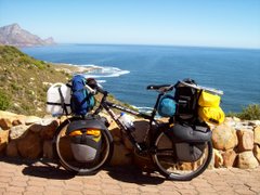
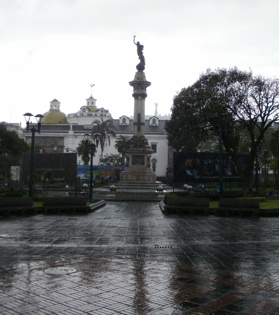
The town of Baños (where I ended my last report) is already a fair way up between the Amazon Basin and the Central Highlands of Ecuador, and as the three of us cycled onwards we were entertained by views of the smoking vulcano which we were leaving behind (Phillip and Isa had gone ahead the previous day). As we moved North the road took us past a number of other high mountains, mostly vulcanos. One of the mountains we passed is the extinct Vulcan Chimborazo, and at well over 6000 metres above sea level it is the highest mountain in Ecuador (and due to the equatorial bulge it's summit is the furthest point from the centre of the earth). However, the second-highest mountain, Vulcan Cotopaxi, is by far the most spectacular (and at nearly 6000 m it is apparently the highest active vulcano in the world). Therefore we made a diversion off the paved roads into the Cotapaxi National Park. Once again, with my narrow pavement tyres I had lots of "fun" climbing up the rather poor gravel road into the Park where we camped at an altitude of close to 4000 m (fortunately there was a hut in which we could camp, as there was a freezing wind blowing). We were very fortunate that the day was perfect with blue sky, so I took about a million photo's of that mountain. The following morning was also OK, but soon the clouds rolled in again, obscuring most of the vulcano as we looked back. On that day we had to descend down towards the Pan Americana again, firstly on a terrible gravel road, and then for about 10 km on a slippery uneven cobblestone "Big Dipper" (even though I was constantly on the brakes I still suffered a broken spoke). Then it was Northwards on the Pan Am highway, and now eventually I've arrived in the capital of Ecuador, Quito. There is a new part to the city, but the Old Historic Centre is quite wonderful to see. For the past few days Hannes, Annelies and myself have been staying in the new Casa De Cyclistas in the new part of town, where we met up with Phillip and Isa again. We'll probably move on tomorrow to another Casa De Cyclistas a few k's outside Quito, and stay there for a couple of days before heading North to the equator about 20 km away. Daily distances cycled since Cuenca have been:- Palmas 82 km; Mt Camp 60 km; Mendez 42 km; Macas 79 km; Puente Pastaza 66 km; Puyo 69 km; Baños 62 km; Pillaro 47 km; Laso 58 km; Cotapaxi NP 28 km; Machachi 39 km; and Quito 44 km. The total distance cycled in South America so far is 16 964 km, and the total distance which I've cycled so far on this journey is 83 451 km.

Monday 17 October 2011

EL ORIENTE


From the Southern Highland city of Cuenca I cycled East down to the Upper Amazon basin of Ecuador (known as El Oriente locally). I'd arrived in Cuenca together with fellow cyclists Hannes and Annelies, and on leaving Quenca we were joined by Swiss cyclists Phillip and Isa. To say that we cycled "down" to the Oriente is not completely correct - it was rather a case of "ups and downs". The scenery along the way was spectacular, although often the hills were very steep and the road was unpaved in sections. The first mountainous part was through luscious cloud-forest, with it's accompanying mist and rain. Once down in the Amazon Basin the climate was quite different to that of the highlands, and I hadn't experienced that type of heat and humidity since Eastern Bolivia some months ago. However, it was a nice change, cycling through the tropical forest with all sorts of exotic flowering plants. We camped once in the rain, but stayed over mostly in village hostals. Once we were fortunate to camp inside a disused restaurant, as it really stormed during the night. While on the subject, I'll reply to Peter Z's curiosity as to why one would want to camp inside a building. In this case we were in the tropics, so the tent keeps out all the bugs such as mosquito's, sand flies, and spiders. Camping inside a school literally puts you in the eyes as the kids stare through the windows, so the tent allows for some privacy when changing clothes, etc. At high altitude the tent lends additional insulation agains the cold, and if it rains then at least a person is not confined to the tent - you can sit outside to cook and socialise. If I camp in the same spot for a few days (such as on the old fishing platform in Penang) then the roof protects the tent from baking in the sun, and when I walked off to the shops I could secure my belongings inside the tent. So, generally, camping inside is what I call "easy camping". My cycling companions are early risers so they usually leave before me in the mornings and I catch up with them later. As a result I was on my own for a day or two after somehow losing the others along the way. From the town of Puyo we climbed up again towards Baños and the Central Highlands of Ecuador. Baños is a very touristy town, and there are hordes of Gringo's as well as local tourists. The town derives it's name from the local hot springs, and there is also a huge smoking vulcano looming overhead. All manner of amusement equipment is for hire, and as I cycled up from Puyo I was passed in the opposite direction by swarms of Gringo's wearing river-rafting helmets and barreling downhill on rented mountainbikes. Next I'll be heading North through the vulcano-studded Central Highlands.

Wednesday 5 October 2011

THE SOUTHERN HIGHLANDS


I don't seem to be able to get away from the Andes Mountains, and so far in the Southern Highlands of Ecuador it has been an up and down affair. I've reached the "Charming City", and third-largest in Ecuador, Cuenca. The city centre of Cuenca is truly beautiful, It is on the banks of a small river, and there are many wonderful historic buildings (many of them are impressive churches). In Loja I'd met up with cycling friends Hannes and Annelies, but while I waited for my new bank card to be delivered they moved on. From Loja I took a small dirt road for the first section North, which was reportedly more scenic than the main road, and there were interesting tribal people in the area (the men wear their hair long in plats or pony-tails, so if it wasn't for my beard I may have fitted in there). However, the weather had been rainy for the previous few days, and I had some fun in the mud with my loaded bike on narrow slick tyres. Further North I met up with my two friends again, after they had sheltered from the rain for a couple of days. In the village of La Paz we camped in a school room in exchange for a donation to the school Xmas fund. Before we even unpacked the bikes Hannes had organised a football game with the kids, and of course I was roped in as well. Some time into the game I picked up an "injury", and was replaced by a more effective player half my size and one-fifth my age. Talk about size, it may sound unbelievable but when I walk down the city streets I've noted that most of the people are shorter than me. In this region it is also rather unfortunate to be a pig, because pigs are being barbequed and cooked in all different ways in roadside stalls. I've been relaxing in Cuenca now for a few days, and tomorrow the three of us intend to cycle down to the Amazon basin (known as the Oriente)towards the East of the mountains, which hopefully will be a nice change of scenery. Daily distances cycled since Trujillo in Peru have been:- Huanchaco 14 km; Dios (+30 km police lift) 93 km; Chiclayo 92 km; Olmos 110 km; La Matanza 104 km; Piura 68 km; Las Lomas 119 km; Macara 57 km; Languche 59 km; Catacocha 37 km; Catamayo 61 km; Loja 39 km; Saraguro 64 km; Ona 38 km; La Paz Pueblo 39 km; and Cuenca 72 km. The total distance cycled so far in South America is 16 288 km, and the total distance cycled so far on this trip is 82 775 km.