Monday 19 December 2011

THE GRAN SABANA


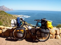
In Central Venezuela I left the Orinoco River and headed in a Southerly direction towards the Gran Sabana and the famous Cainama National Park. In contrast to the rest of Venezuela where I´ve been so far, the Gran Sabana is a grassy highland fringed by flat-topped rocky mountains in the distance. I had to climb up to this area on a 30-km section of road aptly named La Escalator (fortunately it was raining as usual, so at least I didn´t overheat). Due to it´s altitude this region is also a bit cooler than the tropical lowlands. The Angel Falls are also in this park (although getting there involves taking a guided tour from a different place to where I was cycling). After turning South from the Orinoco I at first passed through some towns and farming countryside before getting to the Gran Sabana. Asking for directions from a group of men in one town where I arrived after dark, one man suggested that I camp amongst the scrap metal under a roofed area next to his house. He then proceeded to prepare an interesting dinner for me and himself amongst the tools and scrap metal in his kitchen, and offered me plenty of coffee which he served in a plastic margarine container (his overgrown back yard served as a toilet, which seems to be quite common in some rural areas of Venezuela). Petrol is dirt-cheap in Venezuela, and as a result there are many big old crab-walking American-model V-8 cars and trucks on the road. Drinking and driving seems to be a national sport, and in the National park where one can spot the litter in the roadside grass, I counted 235 empty beer cans in a single km only on one side of the road. I also amused myself in other ways, such as hanging dead snakes over my bike and taking pictures of them. Distances are given in hours (not km), and I´ve found that some people think I average about half the speed of a car! Whether I ask or not, I´m often informed that the road ahead is flat (plano), which it has never been. At the Southern extreme of the Gran Sabana is the Brasilian border, where I now find myself. Distances cycled on this section were:- Upata 92 km; Guasipati 114 km; El Dorado 105 km; San Isidro 104 km; Rio Kamoiran 84 km; San Francisco De Y. 81 km; Pacaraima (Brasil Bdr) 84 km. The total so far in South America is 20 869 km, and the total distance I´ve cycled so far on this trip is 87 356 km.

Monday 12 December 2011

ORINOCO FLOW


From Puerto Carreno in Columbia I had to cross the mouth of the Rio Meta in a small boat to Puerto Paez in Venezuela, and then I had to take the car ferry across the mighty Orinoco river. From there I could take the road East towards Bolivar city and central Venezuela. I stamped out of Columbia at the local immigration office in town, where I was informed that there was indeed a Venezuelan passport control point in Puerto Paez. Unfortunately there was no such thing, and I had to cycle 100 km South up the Orinoco river (and back) to Puerto Ayacucho where I could officially be stamped into Venezuela. (Finding the immigration office was a mission in itself, as the place was in a shed in the industrial area way out of town). Further, I was reliably informed that the road through this part of Venezuela was really good all the way to Bolivar city. On the contrary, the very rutted and poorly constructed tarred road comes and goes - with the unpaved sections easier to cycle on. Of course, in isolated areas there are usually lots of interesting people, and this area has been no exception. I´ve camped at farms, roadside bars, cock-fighting clubs, and in mud huts in small communities. One day I spotted a water tap at a bodega, and when I stopped there to fill up I met the 3 stooges in picture (they were working their way through a case of beer which they´d bought there, and insisted that I help them with the task). This route roughly followed the huge Orinoco river, and every day I crossed tributaries which are big rivers on their own. There are also some indigenous tribes living in the area, and one day I came across a group of men on bicycles, wearing their traditional g-strings (they wouldn´t let me take a picture of them). There´s not much in the line of road signs indicating distances, and the few such signs have been comically incorrect (one needs a sense of humour when distances indicated to the next town are 40 or 60 km short). However, without too much ado I´ve managed to reach Bolivar city, and soon I´ll start cycling in a Southerly direction. Daily distances cycled since I crossed the river from Columbia into Venezuela have been:- Pavoni 39 km; Puerto Ayacucho 76 km; Pavoni (return) 65 km; Tirital 80 km; Bicochuelo 94 km; Caicara 113 km; Maripa 103 km; Santa Jose Pao 104 km; Curiapo 104 km; Cd Bolivar 110. The total distance cycled so far in South America is 20 205 km, and the total for this trip is 86 692 km.

Thursday 1 December 2011

THE RIO META


I was desparate to get some decent info before heading through Eastern Columbia along the Rio Meta towards Puerto Carreño and the Venezuelan border. I was aware that the river was widely used for transport, but due to the flood plains of this big Orinoco tributary the map indicated that I would usually be quite a distance from the water. However, locals don´t travel all the way along this route, and I was told that the road was anything from 200 to 350 km long (or just far). For 2 days I battled along a terrible bumpy and dusty road, and I found it better to cycle on paths alongside the road where possible. Then 2 things happened:- I branched off that road onto a series of jeep-tracks and footpaths, and the rain started. Often over the following days the water stood so deep that I couldn´t make out the track I should be cycling on. I had many spectacular falls during that time. There were also many times when I had to drag my poor old bike through sucking black swamps, destroying my sandles in the process. Unfortunately my camera didn´t survive all the falls and the water, so the last picture I took on this section is the one where my bike is lying in the road on a good day. However, a strange thing happened, and I picked up a Blackberry in the middle of nowhere the day after my camera broke (it seemed slightly damaged and didn´t seem to be in working order, but I kept it anyway). I lost my way quite a number of times, as it was often diffucult to decide which one of a maze of tracks was the actual highway. So much for complaining. This part of the country is cattle-ranching land, and I camped at farmsteads quite a number of times. I found the farm people and the cowboys to be wonderful people, and they were more than willing to accommodate me. Without fail I was offered food as well, usually before I could even pitch my tent (always under the cover of their roof, to shelter from the rain). There is only one proper town about half-way along this route, an interesting place called Prima Vera. I stopped in there to do some shopping, and before I knew it a crowd had gathered and I was being interviewed by the local TV channel who followed me all the way out of town with their cameras. All along the way I still couldn´t figure out how far the end of the road at Puerto Carreño was, so I just made sure that I had enough food with me for a few days, but clean drinking water started to become a problem in some isolated areas later on. I imagined that I was bullet-proof, and a few times I drank water from suspect sources. As can be expected, the suspect water took it´s toll and caused me to become extremely ill, not being able to take in any food or drink for a couple of days (eventually I collapsed at a farmhouse early one day, where I lay until the following morning when I felt strong enough to continue). After what seemed like forever, 750 km later, I rolled into Puerto Carreño where the local Fire Brigade have been happy to evacuate an office where I´ve been able to camp for a couple of days. Further, I´ve been able to charge the battery of the Blackberry which I´d picked up, and I was happy to find that at least the camera still works (so I am able to take some simple pictures). Daily distances cycled since I last reported distances from Cali have been:- Andalucia 122 km; Armenia 90 km; Cajamarca 37 km; Ibague 78 km; Fusa 103 km; Bogota 63 km; Villavicencio 90 km; Puerto Lopez 109 km; Puerto Gaitan 115 km; Matanegra 57 km; Karim Aguas 54 km; Finca Carillo 68 km; Finca Marabre 44 km; Finca Virgen 58 km; Prima Vera 31 km; Santa Barbara 60 km; Antiguaneuvo 56 km; La Vendicion 74 km; Rio El Chiqui Chaque 62 km; La Esperanza 46 km; Finca Tienda 65 km; Puerto Carreño 75 km. The total distance cycled in South America to date is 19 317 km, and total for the trip is 85 804 km.

Wednesday 16 November 2011

LA LINEA


I´d had a nice 2 days rest in Cali, South Western Columbia, where I had enjoyed the hospitality of Miller and his family at their Casa De Ciclistas (the morning I left Miller wasn´t there to see me off, and the girl in picture is an Argentinian cyclist who arrived the day after I did). From Cali most touring cyclists head roughly North via Medellin to Cartagena on the Columbian Carribean coast. However, I took a major diversion, heading East towards the Andes Range again, and to the capital of Columbia, Bogota. Before reaching the Andes I cycled through the picturesque coffee-growing area around the town of Armenia, where I camped in the rain in a field close to a farm house (and the people came out with supper for me, as well as breakfast the following morning). Then it was the mean steep climb in the rain up the Mountains again - called La Linea in these parts. As if the hill wasn´t enough, I has some trouble with punctures, going through all my spare tubes in the process. Just after the summit at an altitude of 3 300 m I had to repair a tube, and I took shelter in the simple house of some mountain people in order to do the job (they were very friendly and excited about this chance visit, they called me ¨Señor¨and kept offering me coffee). But that wasn´t the end of the mountains! Typically the road went way down again past Ibaque, and then I had to climb up to Bogota which is situated at an altitude of 2 600 metres. It was raining again as usual, but I found refuge at the wonderful La Candilara branch of the Fire Brigade (they moved one of their trucks so I could camp in the garage, they gave me food, and when I left the following morning I was presented with an official Bogota Fire Brigade T-shirt and cap). After another climb out of the city, the road dropped from 3 000 metres to an altitude of 100 m in about 100 km to the city of Villavicencio. From Villavicencio I had a wonderful new flat road of about 200 km to the bustling river port town, called Puerto Gaitan. I knew that my good-road experience was about to end, but nobody could give me any decent info on what lay ahead to the East. I bought 2 off-road tyres anyway, because I had a feeling that I would need them. (Cycling distances are included in the following post).

Tuesday 8 November 2011

CROSSING THE LINE


Regardless of all the lines which I've crossed which I shouldn't have crossed, I've now crossed the EQUATOR for the third time. The first crossing was on my way North in Kenya, and the second crossing going South in Sumatra (I actually missed the line and didn't even get a photo). Anyway, in this case my North-bound route crossed the line a number of times as the road snaked through the hilly Ecuadorian landscape, and I was so keen not to miss it again that I found myself taking pic's of the bike in the middle of nowhere (the GPS indicated 0 degrees). However, eventually there was a monument and a large sun-dial laid out in stone, and all the paraphanalia that goes with it. Other lines which I've crossed on this trip have been the Tropic of Capricorn (3 times), and the Tropic of Cancer (8 times). Anyway, my last report was from Quito where I was staying at the Casa De Cyclistas in the city (Carlos, Daniel, and Santiago, with dogs in pic). From there Hannes, Annelies, and myself did a short hop down to Tumbaco where we stayed at another "Casa" owned by another Santiago (in picture still in his pajamas) - I was his first South African guest in the 20 years he's been hosting touring cyclists. The garden was spacious, so Hannes stoked up a braai (Argentinian style ASADO). From there we followed a cycle track which runs along a disused railroad for about 40 km (very nice, no traffic, beautiful scenery and even a number of nice dark tunnels). At Otavalo I said goodbye to my cycle companions, and subsequently crossed another line - the border from Ecuador into Columbia. In the hilly South of Columbia I met a number of other cyclists including Marta from Poland and her Argentinian companion in picture. I also met a group of 3 Columbian cyclists on the day when I reached Cali (2 days ago). I've been staying in Miller's Casa De Cyclistas in Cali, and although I was planning to move on this morning it was raining so persistently that I decided to stay and visit the Internet Cafe. Talk about rain, there is no shortage of it here with the daily (or nightly) thunderstorms. I've been camping all along, and in order to ecape the rain I've stayed in some interesting places such as schools, military check-posts, and road-work camps. On the first night after crossing into Columbia I asked to camp in a field next to a "village" farm house, and the family showed me to camp in the back yard which they considered to be safer. There I spent the night in close quarters with a barking dog, a grunting cow in labour, a goat, two cats, geese and chickens, and cages full of guinae pigs. The matriarch of the Baez family was in charge of the place, and in addition to doing farm-work, the grown daughters also did quite well in having children from foreign men (mostly South Americans). I was given a good breakfast the following morning, and although they may have been hinting at a South African addition to the family, I was feeling a bit too worn-out from a restless night amongst all those animals! From Cali I'll probably head off tomorrow in a North-easterly direction towards Bogota (over the Andes again!). Daily distances cycled since Quito have been:- Tumbaco 17 km; Quinche 44 km; Otavalo 76 km; Bolivar 95 km; Ipiales 84 km; Cebadal 57 km; Bridge Camp 73 km; Patia 102 km; Paraga 55 km; Popayan 68 km; and Cali 125 km. The total distance which I've cycled so far in South America is 17 760 km, and the total distance which I've cycled on this journey is 84 247 km.

Monday 24 October 2011

VULCANO-LAND


The town of Baños (where I ended my last report) is already a fair way up between the Amazon Basin and the Central Highlands of Ecuador, and as the three of us cycled onwards we were entertained by views of the smoking vulcano which we were leaving behind (Phillip and Isa had gone ahead the previous day). As we moved North the road took us past a number of other high mountains, mostly vulcanos. One of the mountains we passed is the extinct Vulcan Chimborazo, and at well over 6000 metres above sea level it is the highest mountain in Ecuador (and due to the equatorial bulge it's summit is the furthest point from the centre of the earth). However, the second-highest mountain, Vulcan Cotopaxi, is by far the most spectacular (and at nearly 6000 m it is apparently the highest active vulcano in the world). Therefore we made a diversion off the paved roads into the Cotapaxi National Park. Once again, with my narrow pavement tyres I had lots of "fun" climbing up the rather poor gravel road into the Park where we camped at an altitude of close to 4000 m (fortunately there was a hut in which we could camp, as there was a freezing wind blowing). We were very fortunate that the day was perfect with blue sky, so I took about a million photo's of that mountain. The following morning was also OK, but soon the clouds rolled in again, obscuring most of the vulcano as we looked back. On that day we had to descend down towards the Pan Americana again, firstly on a terrible gravel road, and then for about 10 km on a slippery uneven cobblestone "Big Dipper" (even though I was constantly on the brakes I still suffered a broken spoke). Then it was Northwards on the Pan Am highway, and now eventually I've arrived in the capital of Ecuador, Quito. There is a new part to the city, but the Old Historic Centre is quite wonderful to see. For the past few days Hannes, Annelies and myself have been staying in the new Casa De Cyclistas in the new part of town, where we met up with Phillip and Isa again. We'll probably move on tomorrow to another Casa De Cyclistas a few k's outside Quito, and stay there for a couple of days before heading North to the equator about 20 km away. Daily distances cycled since Cuenca have been:- Palmas 82 km; Mt Camp 60 km; Mendez 42 km; Macas 79 km; Puente Pastaza 66 km; Puyo 69 km; Baños 62 km; Pillaro 47 km; Laso 58 km; Cotapaxi NP 28 km; Machachi 39 km; and Quito 44 km. The total distance cycled in South America so far is 16 964 km, and the total distance which I've cycled so far on this journey is 83 451 km.

Monday 17 October 2011

EL ORIENTE


From the Southern Highland city of Cuenca I cycled East down to the Upper Amazon basin of Ecuador (known as El Oriente locally). I'd arrived in Cuenca together with fellow cyclists Hannes and Annelies, and on leaving Quenca we were joined by Swiss cyclists Phillip and Isa. To say that we cycled "down" to the Oriente is not completely correct - it was rather a case of "ups and downs". The scenery along the way was spectacular, although often the hills were very steep and the road was unpaved in sections. The first mountainous part was through luscious cloud-forest, with it's accompanying mist and rain. Once down in the Amazon Basin the climate was quite different to that of the highlands, and I hadn't experienced that type of heat and humidity since Eastern Bolivia some months ago. However, it was a nice change, cycling through the tropical forest with all sorts of exotic flowering plants. We camped once in the rain, but stayed over mostly in village hostals. Once we were fortunate to camp inside a disused restaurant, as it really stormed during the night. While on the subject, I'll reply to Peter Z's curiosity as to why one would want to camp inside a building. In this case we were in the tropics, so the tent keeps out all the bugs such as mosquito's, sand flies, and spiders. Camping inside a school literally puts you in the eyes as the kids stare through the windows, so the tent allows for some privacy when changing clothes, etc. At high altitude the tent lends additional insulation agains the cold, and if it rains then at least a person is not confined to the tent - you can sit outside to cook and socialise. If I camp in the same spot for a few days (such as on the old fishing platform in Penang) then the roof protects the tent from baking in the sun, and when I walked off to the shops I could secure my belongings inside the tent. So, generally, camping inside is what I call "easy camping". My cycling companions are early risers so they usually leave before me in the mornings and I catch up with them later. As a result I was on my own for a day or two after somehow losing the others along the way. From the town of Puyo we climbed up again towards Baños and the Central Highlands of Ecuador. Baños is a very touristy town, and there are hordes of Gringo's as well as local tourists. The town derives it's name from the local hot springs, and there is also a huge smoking vulcano looming overhead. All manner of amusement equipment is for hire, and as I cycled up from Puyo I was passed in the opposite direction by swarms of Gringo's wearing river-rafting helmets and barreling downhill on rented mountainbikes. Next I'll be heading North through the vulcano-studded Central Highlands.