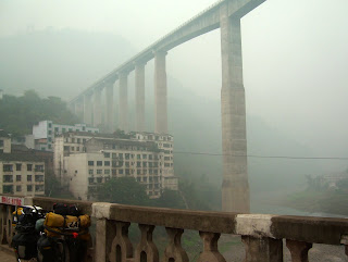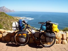


After leaving Xichang city, Leana and I cycled down-river to our next destination of Yibin at the confluence of the Min and Jinsha Rivers, forming the Yangzi River (this may be a bit confusing, as the "Jinsha" is also referred to as the "Yangzi" further upstream). To put it mildly, every day on this stretch has been full of surprises. What also adds to the surprise is that my "maps" are remarkable in their lack of detail (no distances, major towns not listed or in the wrong place, and many place names only written in Chinese script - which, again, does help when asking for directions). Firstly, to get "down-river" we spent the entire first day cycling up a mean mountain, and camped in the freezing cold at over 3100m where our water bottles froze and ice formed on the tents. Over the next 2 days we descended in an Easterly direction for about 150 km before climbing over more high mountains to Leibo lake in the historic Mahu district. Often we cycled on roads of which the surface has been totally destroyed by landslides and rock-falls (at times stones were falling all around us, but fortunately none found their target). However, the scenery was spectacular and the isolated ethnic villagers were wonderful to meet (bustling market-towns with colourfully-dressed villagers and their animals). At times it felt as if I could be in a place like Peru (incidently, I've never been to Peru), as the people were wearing tassled poncho's, women had long plaited hair, scruffy ponies are a popular beast of burden, and homesteads were often almost out of sight way up the mountainside at the end of unbelievably steep footpaths (therefore people also carry heavy loads). As we descended from the highlands into the Sichuan Basin, we found ourselves cycling in a misty haze (a regional winter problem formed by dust and pollution which settles in the deep river valleys). This part of China is also being feverishly developed on a huge scale - incredible highways and cities arising from what were recently still villages. To reach Yibin from where we were in Sichuan province, we had to cross to the South of the Jinsha as far as the city of Shuifu in Yunnan province. The only direct road between Shuifu and Yibin is a new expressway (bicycles not permitted), but we took our chances. About half-way to Yibin the police stopped us at a toll gate, but there was no exit from the highway so they called a pick-up truck from Yibin to load us up and take us about 20 km to the city. (The police are very friendly here, they were even taking photo's of us). Daily distances cycled since Xichang were:- Mtn camp 47 km; Junction town 85 km; Road camp 93 km; Leibo 7 km; Mahu 50 km; Bridge town 58 km; Shuifu 90 km; and Yibin 22 km. Total distance cycled since leaving Cape Town at the start of this journey is 49 424 km.


