


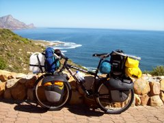
Lake Titicaca, which straddles the Bolivia/Peru border, is the world`s largest high-altitude lake (also referred to as the highest navigable lake). The lake located towards the NW end of the Andes high plains, and is at an altitude of over 3800 m above sea level. After the climb out of La Paz city back up to the Altiplano, I made it to the lake shores by evening. Since then I`ve cycled more than 200 km along the lake, taking one of the many suspect-looking ferries over a channel along the way. There are a couple of decent hills along the way, taking the road up as high as 4300 metres (good views of the Andes peaks in the background). On the first day along the lake shore I didn`t make much headway, taking photo`s but there was also some festival going on in a number of the lakeside villages. The festival involved a slow parade in the street, with elaborately dressed groups of women and men doing "Square Dancing", and followed by a brass band as they slowly moved along. I knew there were some big hills after the ferry crossing, and as I was already struggling to breathe I stayed over in San Pedro village where the ferry dropped me off. The local population around the lake shore consists mainly of smallish-built indigenous people (see the size of the door in my room - and I´m by no means a giant, to say the least!). My last stop-over in Bolivia was a relaxing couple of days at the lakeside "resort" town of Copacabana, with it´s Moorish-style cathedral. After an effortless border crossing into Peru, I´ve cycled along the seemingly colder Western shores of Lake Titicaca up to the interesting touristy town of Puno. It´s supposed to be the dry (winter)season here, but on my approach to Puno I cycled through some freezing cold sleet, and it´s been raining on and off for the 2 days that I´ve been here. Puno is the favourite place for tourists to visit some of the interesting lake islands (such as the floating grass islands), and the small harbour area is crammed with tourist craft. As I´ve mentioned it is rather cold here, even the moto-taxi`s are covered. I also bought a local knitted cap which makes me look a bit silly, but it keeps my ears warm and has a double layer - handy if it starts to look a bit grimy I can just turn it inside-out! I suppose I can´t hang around here forever, so even if it rains tomorrow I´ll head towards Cuzco and the famous Inca-ruin region. Distances cycled since La Paz haven´t been phenomenal, but at this altitude one is held back by a limited oxygen supply. Those distances are:- Huarina 78 km; San Pedro 40 km; Copacabana 41 km; Juli (Peru) 63 km; and Puno 84 km. Total distance in South America so far is 12 703 km. Total distance cycled on this trip is 79 190 km.


3 comments:
good biketrip...good blog... i like it... bye bye
Ernest, you are a legend!!! We were just discussing a friend's hike in the Appalachia mountains (he's doing the entire trail, some 2000 miles) and remembered you again. AMAZING, what can I say... Wishing you all the best, keep cycling ;-) Greetings, Lotta & Craig from Zomba Plateau
Greetings! This is Mark du Preez, live from Bainsvlei, Bloemfontein, South Africa.(Your Sister's son) I'm happy for you that you're still moving on. It's been a wile! I'm very proud of you!! I wish for you to remain positive and keep on enjoying life the way you wanted to. You have the most awesome photos on your blog!Hang in there, and the best of luck. I'll remain in touch. Sleep well tonight. Mark.
Post a Comment