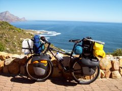
By the time most of you read this report I would have left Cape Town again after a 3 week fattening-up period. During this time I've seen most of my friends (plenty of braai's, so I've grown into my skin again). Apologies to those I did not see, I obviously didn't manage my time very well. I lost the beard, mainly because it was scaring those people closest to me. My bike (old Saartjie) has been given a new lease on life, thanks to Leon and Jaco at Cycle Maintenance Centre. Further thanks to CMC for their generous sponsorhip of spares and labour on the bike (new Sram components, Continental tyres, etc.) Thanks also to Canvas and Tent for replacing the poles on my Bushtec tent. Tomorrow I return to Addis Ababa, where I hope the rest of my belongings are still safely locked away. Leana will be joining me from Addis onwards, for the time being. We will probably spend the next week or so there, organising visas, etc. From experience I know that the internet in Ethiopia is too slow for me to post reports and photo's, so it may be a while before my next update. Please be patient! Thanks again to all those who leave comments on this site, or who send me e-mail.
Wednesday, 7 November 2007
Monday, 15 October 2007
UP THE RIFT VALLEY


As I write this report I'm looking out the window of an Etiopian Airlines flight on my way back to South Africa. I'll be in Cape Town for a few weeks, courtesy of my sister Olga. It's a strange experience flying back over the ground I'd covered during the past six and a half months, almost like a quick rewind of a very long movie. I'm using the opportunity to take my bike back with me for the necessary attention (hopefully Old Saartjie is indeed in the hold of the plane). Since Nairobi I've only had the one off day in Marsabit, and I feel that I need a good rest. I've also had to push on through the scenic but hilly Southern Ethiopia in order to make my flight date in Addis Ababa. With the heavily loaded bike on the many big slow hills, an aggravation along the rural roads is the hordes of youngsters making a nuisance of themselves (chanting "you-you", "ferange", and "give me .... whatever"). They also attempt to pull luggage off the bike, throw stones, and there was even the odd effort to get a stick in the spokes. In Addis I found the people to be more welcoming, and I've really enjoyed the 2 days there. Most of my belongings remain in Addis for when I return to continue my journey. Other good things about Ethiopia are that the food is very good, and things are very cheap (just avoid the tourist traps). Things I've found odd about the country are that their clock is 6 hours different, they're about half a month behind, they have their own alphabet, they drive on the "wrong" side of the road, and they are currently celebrating the millenium. Distances since Moyale were:- Mega 113 km; Yavello 103 km; Agra Maryam 100 km; Dilha 95 km; Shashemene 113 km; Meki 122 km; Debre Zeit 92 km; and Addis Ababa 54 km.
KENYA NOMADICS


After leaving Nairobi I took the scenic route to the East of Mt Kenya. This region is more tropical than the drier Western main road, with tea and coffee plantations on the hillsides, and bananas and rice in the valleys. "Scenic" usually comes at a price, and the price was "no flat road", only long steep ups and downs. In the process I also crossed the Equator. To the North of the mountain the climate abruptly changed, and from Isiolo I was on very poor dirt roads slowly making my way through the arid landscape where there are a number of colourful tribes (including the Samburu). Wherever possible I cycled on goat- and camel tracks, trying to keep the road in my sight. However, I discovered that a goat is shorter than a man on a bicycle, as a number of times I found myself hooked up and bleeding in the thorns. Another hazard on the roads is the local "busses" (trucks with passengers on top), kicking up dust and stones at full throttle. By the end of the day I tended to look like a rat that rolled in mealie meal. My only rest day after Nairobi was in Marsabit, before I continued North through the volcanic rock desert to the Ethiopian border at Moyale. The "road" was almost impossible and villages were far apart, forcing me to spend nights in the desert with very little water (once there was a sand storm which lasted most of the night). Armed bandits in the area regularly hijack trucks, but fortunately I had no such problems (perhaps they pitied me because of my bedraggled appearance). Distances since Nairobi were:- Sagana 118 km; Chuka 85 km; Meru 58 km; Isiolo 53 km; Archers Post 38 km; Serolipi 67 km; Laisamis 66 km; Logologo 51 km; Marsabit 50 km; Bubisa 47 km; Turbi 60 km; Sololo 73 km; and Moyale 88 km.
Saturday, 15 September 2007
ON SAFARI IN NAIROBI


Three days in Nairobi, and I've gotten most of the things done which I'd intended to do. The bike (Saartjie) has been serviced, I have a visa for Ethiopia, I have a new map of N Africa, I have sandles again, I've done plenty of shopping and eating and drinking, and now I'm doing the internet thing as well. The most significant things en route from Tanzania to Kenya have been my sandles disappearing off the back of the bike (while I was on the bike changing money) at the border, and the chaotic Nairobi traffic for miles before reaching the city. Fortunately I was able to use my little GPS to find "Jungle Junction", where I'm camping. Chris, the German owner of JJ, repairs motorcyles so the place is very popular amongst that sector of travellers. As a result Old Saartjie finds herself in rather illustrious company. Travellers I've met here include Irishmen Sam and Hugh, and Rene from Canada (who I've bumped into twice before on my trip). I've also discovered that there is only a few days difference in age between Hugh and myself (Russian cyclist Uri, who I met in Zambia, was also my age). Perhaps some crazy travelling meteor crashed into earth around the time we were born? Here in Nairobi it's been raining most of the time, starting with a heavy storm soon after I arrived. As the GPS indicated that I was nearing my destination I tried to ask for specific directions, but to no avail. Some of those locals had a good laugh at the crazy Mzungu on a bicycle safari in the city, looking for a "Jungle". Distances since Arusha were:- Namanga 117 km; Kajiado 94 km; and Nairobi 87 km.
Friday, 7 September 2007
FROM ZANZIBAR TO KILIMANJARO


I wasn't planning to go to Zanzibar as it seemed a bit extravagant in the context of my journey. However, I couldn't miss out, so I went there and blew my budget for the next 6 months. I found the island to be interesting and beautiful, but also a bit of a tourist trap. The most affordable accommodation was in the old city (Stone Town) where I stayed most of the time. I cycled to the idyllic palm-lined coral beaches of the East Coast, where I stayed in one of the many resort hotels. There is no camp site on the island, and informal camping is illegal (government tax on tourist rooms). The ferry is also not cheap, and the ride back to Dar Es Salaam was so rough that the guy handing out puke-bags looked like a bar room stripper the way he was swinging on the support poles (fortunately he managed to keep his clothes on). North of Dar I did find a nice camp site at the coastal town of Bagamoyo, where I braai'd fresh Snapper bought from local fishermen. From there I made my way North-West, staying mostly in small village guest houses. The only other Mzungu's I saw during that time were at the windows of the many speeding busses. There was one exception, when I stopped at a roadside motel for a drink I heard Afrikaans being spoken (2 guys from SA who work for Vodacom in Tanzania). I spent 2 days in Moshi at the foot of Kilimanjaro, but unfortunately the mountain was covered in cloud and I only had a glimpse of the peak. I couldn't wait forever for a good view and a photo, so I've moved on to Arusha where I'll stay for a few days (laundry, etc., and bike service). Sorry no photo of Kilimanjaro, but I've included one of a rather weathered climber I met in the mirror. Distances since Dar have been:- Zanzibar 19; Paje 52; Stone Town 53; Kinduchi 32; Bagamoyo 60; Msata 68; Makata 76; Korogwe 89; Hedaru 106; Same 57; Moshi 111; and Arusha 84.
Tuesday, 21 August 2007
COASTING TANZANIA


I thought I'd left the poor roads behind in Mocambique, but that was wishful thinking. As a result I suffered my first puncture since leaving South Africa. At least they are busy building a new coastal road in Southern Tanzania, which has already been completed in sections. I stayed over in Mtwara for a few days to recover from some ailments, and got to enjoy the local lifestyle. There are few tourists in that part of the country, and the locals eat and drink at the many pavement café's. I also tend to buy most of my food from the local markets. The place I enjoyed the most was Lindi, where I could walk to the beach in the morning and buy fresh seafood live from the nets (including king-sized prawns). This bustling town is situated on the shore of a large lagoon. Kilwa Masoko was another place where I stayed over for more than one night. In most of these places I've rented a room, which I've found to be cheaper than camping. A room is also more secure, as I can lock the bike and all my equipment inside. Now I'm in the capital, Dar Es Salaam. I'm staying in the central part of the city, where the streets run at odd angles and the buildings all look the same. In the day that I've been here I've already been lost about 5 times. Amazingly, every time I just kept walking around and soon enough I've found myself at the hotel. Distances since Mtwara have been:- Lindi 112 km; Kilwani 122 km; Kilwa Matoro 81 km; Somanga 83 km; Kibiti 106 km; and Dar Es Salaam 139 km.
Friday, 10 August 2007
DISTANCES, DIRECTIONS, & PREDICTIONS


Arriving in Mocimbao at dusk a few days ago, I was exhausted after a long day and booked into the 1st shabby overpriced room I could find. The bed collapsed during the night, but fortunately there was a spare. I wanted to get Mocambique behind me, and left early the following morning for Palma and the border. After asking directions I was surprised to find that the road was tarred, and assumed it was a recent development as I'd been (reliably) informed otherwise. Twice more I was told that I was indeed on my way to Palma, until after 25 k's I realised that this was the same road I'd used the previous evening. The following day I made it to Palma, and asking for a room or camp site I was pointed down a track which disappeared amongst the palm trees. Enquiring if the place was further than a km, I was told that it was indeed 26 km's, but the road was good (via bon! - thumbs up) and the facilities were of the best. I was a bit apprehensive realizing that he was probably talking about Quionga and I'd been (reliably) informed that the road was terrible. However, it was still early in the day and I had to go that way to reach the border. Two k's later I was sliding down donga's and dragging my bike across sand dunes, but I didn't have the time or energy to concern myself any forther with the misinformation. Three and a half hours (and 22 k's later) I dragged old Saartjie by her ears into a village and, unsure if I had the strength to continue, enquired about the distance left to Quionga. I was informed that I had indeed reached Quionga, and my spirits sank as I couldn't see any nice hotel or camp site (where was that shower and cold drink I'd been looking forward to?). Some of the locals helped me plough through the sand to the far end of the village where a log cabin stood apart on a sprawling plot. There I met Andre and his wife who run a mission station. They were rather amused to hear that they were operating a hotel and camp site, as they'd allowed passing travellers to camp on their grounds from time to time. As it turned out I did camp there and even had a shower (the fresh bread for breakfast was an added bonus). I needed the energy from that bread, because there was another 25 k's of the soft and rough stuff before crossing the river by motorboat into Tanzania. Talking about directions, I think Malawians have been the most inventive so far. A favourite distance there is 9 km (which turned out to be anything from 2 k's to 37 k's). Weather predictions are just a tricky. In Blantyre I pointed out the overcast sky and asked the locals if it meant rain. The response of "no" was still echoeing in the passages when someone shouted from outside to remove washing from the line (it rained for the next 3 days). One day in Mocambique I looked at the heavy sky and asked the guy cycling alongside whether it meant rain (of course he said no). Five minutes later we were sheltering from the heavy downpour under the thatched roof of a roadside market. I did my laundry this am, and when I hung it out the locals predicted no rain. This is already my second day in Mtwara, and hopefully I don't have to stay a third. Distances since Pemba have been:- Sunate 85 km; Macomia 122 km; Mocimbao 149 km; Mocimbao Bay 54 km; Quionga 109 km; and Mtwara 65 km.
Subscribe to:
Posts (Atom)